| In this Section: | |  | In the Spotlight | | News |  |
List of "In the Spotlight" Features
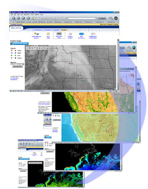
New Maps this Season!
The 2006 season offers a new and improved interactive mapping system! In the Signals of Spring program, students become Life and Earth Science experts. Depending on their expertise (Land Species, Geography, Vegetation, Weather, Marine Species, Bathymetry, Phytoplankton, or Sea Surface Temperature), Student Expert Teams analyze animal location data overlayed on top of Earth imagery from their field.
The new interactive maps offer a lot more functionality including a zoom feature. This not only allows students to get a closer look, but zooming out enables them to get a global perspective as well.
Click here to check them out!
...and stay tuned! More species are being added throughout February.
|